Trekking to Tiger's Nest: what the walk is actually like


The walk to Taktsang — Tiger’s Nest — is a steady uphill climb of roughly two to three hours each way, about 10 km round trip, rising 870 metres to the monastery at 3,120 m. It is not technical, but it is sustained, and the last section crosses a gorge by staircase. Most reasonably fit walkers manage it. Starting early changes the day completely.
The walk in numbers
Trailhead — Ramthangkha road head, 2,250 m.
Monastery — 3,120 m.
Ascent — about 870 m.
Distance — roughly 10 km, out and back.
Walking time up — 2 to 3 hours at a steady, conversational pace.
Walking time down — 1.5 to 2 hours.
Whole day on foot — about 5 hours including the stop at the top.
Halfway point — the cafeteria, at roughly the first viewpoint.
Inside the monastery — no phones, no cameras, no bags; all left at the entrance.
Dress — shoulders and knees covered; long trousers, no vests.
Best start — at the trailhead by 7am.
Our own operating figures, consistent with what the journey pages publish. Times are walking time and exclude the hour or so most people spend at the monastery.
Who this is for
This is for someone who has seen the photograph and now wants to know whether they can actually do the walk.
Anyone who can walk uphill for two hours without stopping to recover. That is genuinely the whole fitness test.
Anyone worried about it. Most of the worry is misplaced, and the parts that are not are named below.
Anyone planning where to put this day in a week, which matters more than most people realise.
Who this is not for
Anyone expecting a viewpoint stop. This is a half-day walk with real ascent, and treating it as a photo opportunity is how people end up turning back at the cafeteria.
Anyone with significant knee problems who has not thought about the descent. The staircases are harder on knees than the climb is on lungs — this is the single most common thing people underestimate.
Anyone arriving in Bhutan that morning. It finishes above 3,000 metres and the day before matters.
What does the walk actually consist of?
It divides into four honest sections, and knowing where you are in them is most of what makes the day manageable.
The road head to the first viewpoint
You start at Ramthangkha, where the vehicles stop and the horses wait. The trail climbs immediately through blue pine, wide and well-trodden, switching back on itself. This is the steepest sustained section of the day and it comes first, which people find discouraging until they are told it in advance. It is also the dustiest.
Forty-five minutes to an hour in, the trees open and you get the first view of the monastery across the gorge. It is further away and higher up than most people expect at that point. This is where the day is psychologically won or lost.
The viewpoint to the cafeteria
Gentler. The gradient eases and the trail contours around the hillside. The cafeteria sits at roughly this level — a genuine building with tea and a toilet, and the point where the horses stop. Most people take twenty minutes here.
The cafeteria to the gorge
The best walking of the day. You climb through forest hung with prayer flags to the high point of the trail, which is actually slightly above the monastery, and come out at a small chorten looking straight across at Taktsang. From here it is close enough to see the woodwork.
The staircases
And then you go down. Somewhere around 700 steps descend into the gorge, past a waterfall, and roughly the same number climb back out the other side to the monastery entrance. It is not exposed and it is not dangerous. It is simply a lot of stairs, taken twice more on the way back, and it is the part that hurts the following morning.
The climb tests your lungs. The staircases test your knees. People prepare for the first and are surprised by the second.
What does starting early actually buy you?
More than anything else you can control. We aim to have people walking by 7am, and the difference is not subtle.
The light. The monastery faces roughly east-north-east and the morning sun reaches it. By mid-afternoon it is in its own shadow and the photographs everyone came for are no longer available.
The temperature. The first section is a sustained climb with limited shade. It is a different walk at 7am than at 11am.
The trail. Most groups leave between 8.30 and 9.30. Starting ninety minutes ahead of that means the climb is quiet and you meet the crowd coming up as you come down.
The afternoon. Finishing by early afternoon leaves the rest of the day usable. Finishing at five does not.
What an early start does not buy is solitude at the monastery itself. Taktsang is Bhutan’s most visited site and it is busy in every season. We are not going to claim quiet or special access, because neither exists and pretending otherwise sets you up to be disappointed by a place that deserves better.
Our judgment — about the horses, and about turning back. Horses go from the road head to the cafeteria. That is the whole of it. They do not go to the monastery, they do not do the staircases, and they are uphill only — riding down is not offered, and would not be pleasant if it were. So a horse removes the steepest hour of the climb and leaves the rest of the day exactly as it was. For someone anxious about the first section this is genuinely useful. For someone hoping to be carried to the door, it is not the solution it sounds like.
On turning back: the cafeteria and the viewpoint above it are both real destinations. We say this before people start, not after they are struggling, because a walker who knows there is a dignified stopping point paces the climb better than one who thinks it is the monastery or nothing. Nobody has ever regretted the viewpoint. Several people have regretted pushing past it on a bad day.
What happens at the monastery?
Everything is left at the entrance — phones, cameras, bags. There is a supervised locker arrangement. This is not negotiable and it is not a formality: Taktsang is an active monastery and the shrine rooms are places of practice, not exhibits.
Inside, it is smaller than the exterior suggests. A sequence of shrine rooms and meditation caves connected by narrow wooden stairs, built into the rock rather than onto it, so the cliff face is a wall in several of the rooms. Most people move through in thirty to forty minutes. Butter lamps, cold stone, the smell of juniper smoke, and — usually — considerably less noise than the queue outside would suggest.
Cover your shoulders and knees. Long trousers, sleeves. Remove hats. Your guide will tell you where photography stops, which is at the entrance, and where to walk clockwise, which is everywhere.
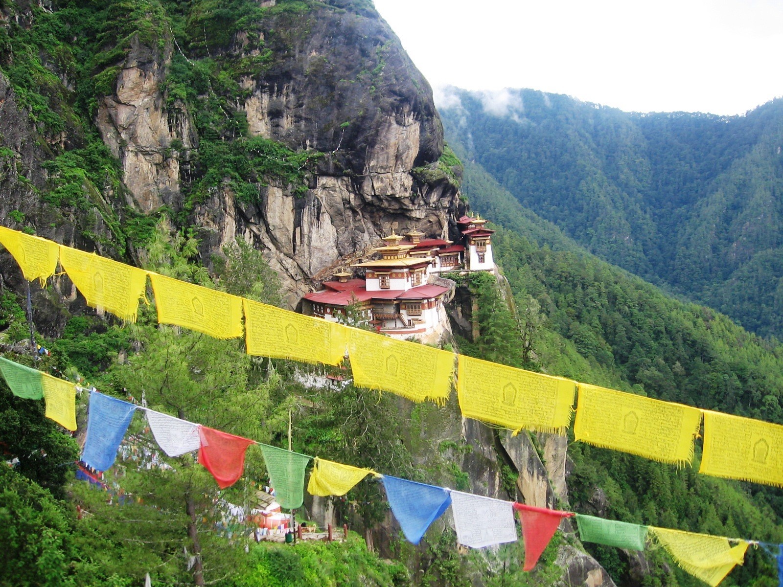
The viewpoint above the gorge — the trail’s high point, and the last of the walking before the staircases.
How should you prepare?
Footwear. Trainers with grip are enough in dry conditions; the trail is a path, not a scramble. After rain it is slick clay and a boot with an edge earns its place. Whatever you wear, it should be something you have already walked in.
Layers. You will be warm within fifteen minutes of starting and cold at the top if you stop. A shell and a mid-layer that both live in a daypack is the whole answer.
Water. Two litres. There is tea at the cafeteria and nothing above it.
Poles. Worth it for the descent even if you would not use them going up. If you have any doubt at all about your knees, take them.
Altitude. This finishes above 3,000 m. That is not high enough to be dangerous for most people, but it is high enough that arriving in the country the same morning and walking straight up is a poor idea.
Where should this day sit in a week?
Not on the first day, and not on the last. Both placements are common and both are mistakes.
Not first, because you will have arrived at 2,250 m the day before, most likely off a long flight, and 3,120 m on tired legs and unadjusted lungs is a harder walk than it needs to be. Not last, because it removes any margin: one bad weather morning and the centrepiece of your week is gone with nowhere to move it.
We put it late in the week but not at the end — day five of six on Sacred Valleys. By then you have spent several days between 2,300 and 3,100 metres, walked the valleys, and crossed Dochula at 3,100 m. The body has done the work quietly. And there is a day behind it to absorb a weather delay.
The day before matters too. We keep it deliberately light — valley-level, short drives, an early night. Not because the walk requires taper training, but because the difference between starting at 7am rested and starting at 7am after a fourteen-hour day is most of the experience.
How this changes the journey. There is a second way to arrive at Taktsang, and it is the reason the Bumdra Sky Camp exists. Rather than climbing from the road head, you camp high on the ridge behind the monastery at around 3,800 m and descend to it the following morning — reaching Taktsang from above, ahead of the crowd coming up, the way pilgrims traditionally approached. It is a harder journey overall and a much easier arrival.
If the climb is what worries you, that route is not the answer — it involves considerably more ascent, just distributed differently. If the crowds are what worry you, it very much is. Compare the two routes and we will tell you honestly which suits you.
Questions we are actually asked
How long does the Tiger’s Nest hike take?
Two to three hours up and one and a half to two hours down at a steady pace, plus around an hour at the monastery — about five hours in total. The round trip is roughly 10 km with 870 metres of ascent.
How difficult is the Tiger’s Nest hike?
Sustained rather than technical. The trail is a well-made path with no scrambling or exposure, but it climbs continuously for the first hour and finishes above 3,000 metres. If you can walk uphill for two hours without needing to recover, you can do it.
Can you ride a horse to Tiger’s Nest?
Only as far as the cafeteria, which is roughly halfway, and only uphill. Horses do not continue to the monastery and are not available for the descent. It removes the steepest section of the climb and leaves the staircases and the final approach unchanged.
What should I wear to visit the monastery?
Shoulders and knees covered — long trousers and sleeves, no vests or shorts. Hats come off inside. Comfortable footwear you have already walked in matters more than technical boots in dry conditions.
Can I take photographs inside?
No. Phones, cameras and bags are all left at the entrance in a supervised locker. Photography is permitted throughout the walk and from the viewpoint across the gorge, which is where the well-known images are taken anyway.
What time should I start?
At the trailhead by 7am. That puts you ahead of most groups, gives you the monastery in morning light rather than its own shadow, and gets you back down with the afternoon still usable.
Is it suitable for children?
Children who are used to walking generally manage it well, often better than their parents. The considerations are the same as for adults: the sustained first hour, the staircases, and the altitude. The cafeteria is a legitimate turnaround point if the day is not going well.
Sources
Neri itinerary data — trailhead and monastery elevations, ascent, distance and walking times are our own operating figures, and match what the journey pages publish. Published third-party figures for the road head vary between roughly 2,100 m and 2,600 m; ours is measured from where our vehicles stop.
Bhutan Tourism FAQs — the guide requirement, which applies to this walk as to every monument and dzong in Bhutan.
Neri field experience — timings, crowd patterns, horse arrangements and the turnaround guidance are drawn from guiding this walk, not from published sources.
See the route. See where this day sits in the six-day route through the western valleys, and what we deliberately schedule around it.
Related Field Notes and next step
Monastery etiquette (To be published)
Choosing between Bumdra and Chomolhari (To be published)